The Hunting Journal App That Turns Every Hunt Into Data
Always Offline.Always Yours.
Record every hunt, track game sightings, capture wind and weather conditions, and discover patterns over time. huntNotes combines a digital hunting journal, mapping tools, and analytics to help you learn from every season.
huntNotes is a digital hunting journal and hunt tracking app built for hunters who want to record every encounter, understand their patterns, and improve their success.
A hunting journal app built for serious hunters. Record hunt results, track game sightings, map stand history, and turn hunting conditions into season insights, on or off the grid.
Digital Hunting Journal
Record every hunt, sighting, harvest, and scouting detail in one place. Entries, waypoints, and photos are stored locally on your device, so the journal works with no signal and your data stays yours.
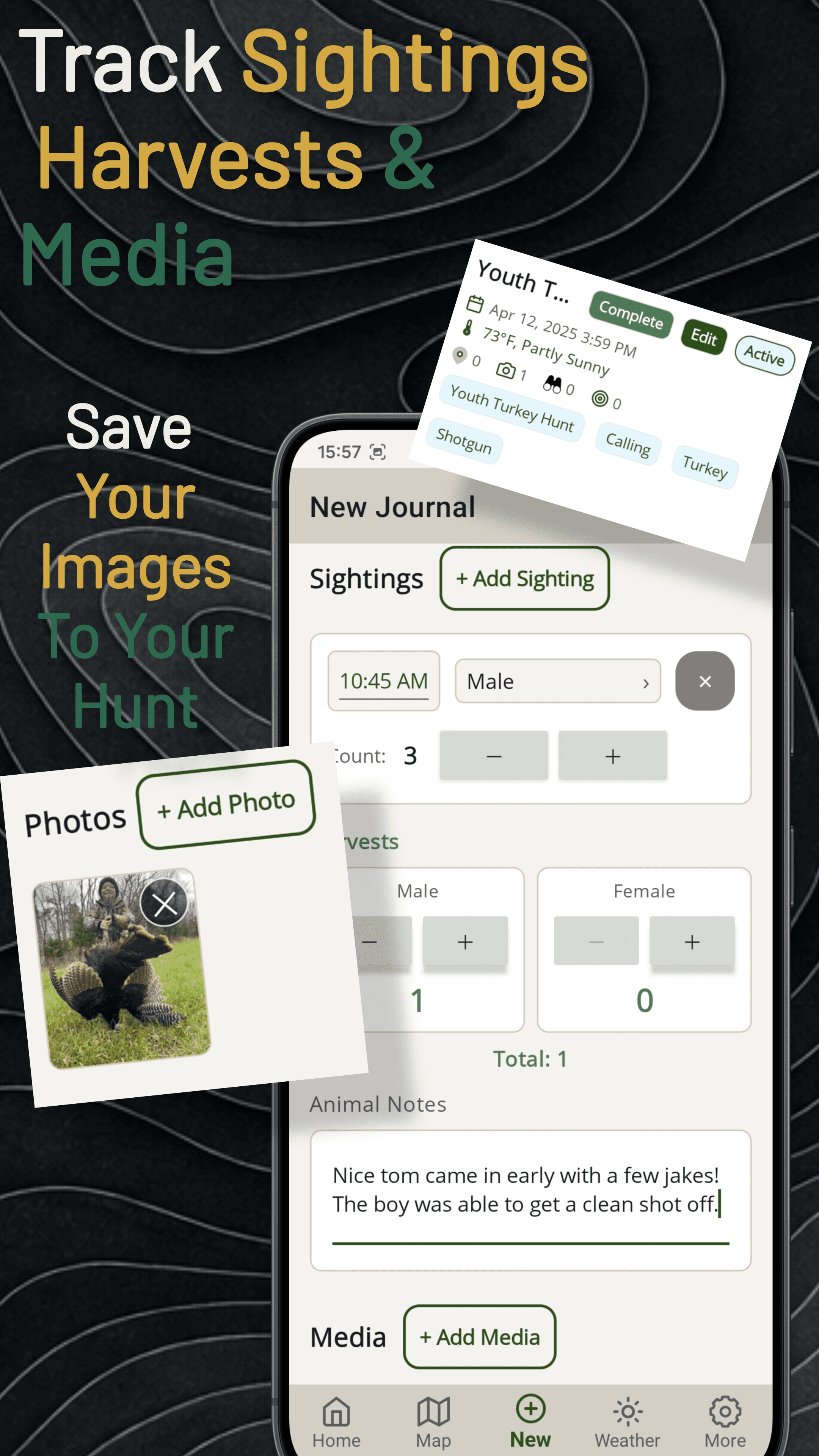
Game Sightings & Harvest Records
Log individual game sightings with sex, count, and timestamps. Keep harvest records by male/female. 25+ waypoint types for stands, scrapes, rubs, and bedding build your scouting observations over time.
Hunting Analytics
Discover patterns from your hunts, sightings, locations, and conditions over time. Season insights, weather correlations, time-of-day animal movement, and hunt results, all computed locally on your device.
Hunt Conditions Tracking
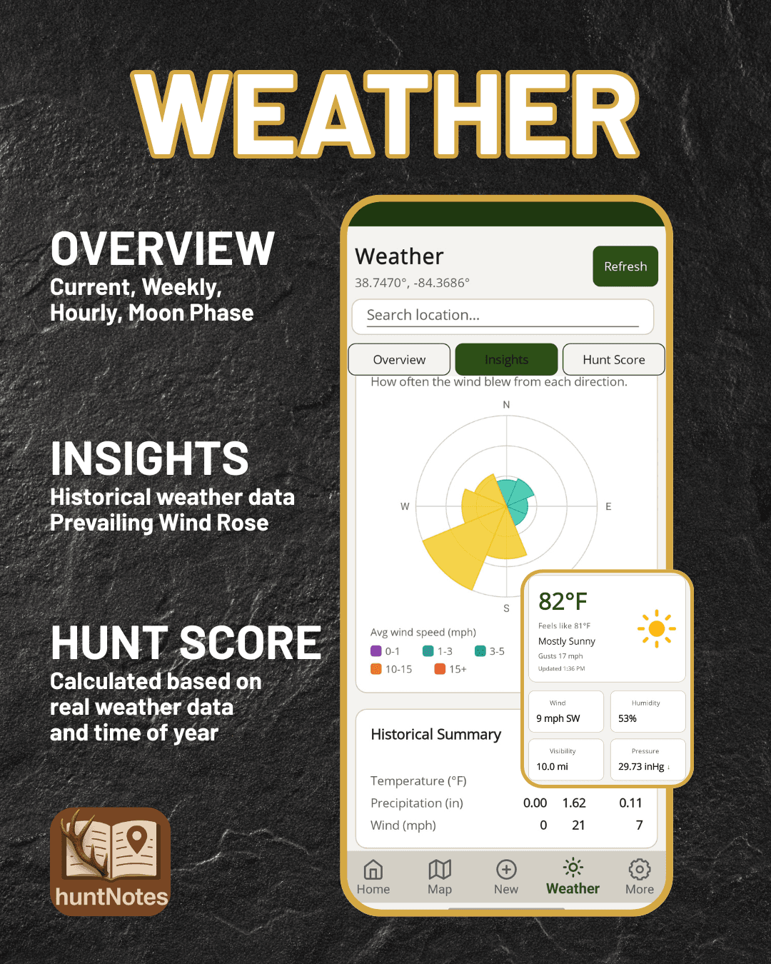
Automatically capture wind, weather, moon phase, and conditions that influence game activity. NWS-powered Overview, an Insights tab with a prevailing wind rose and 2-week to 6-month trend charts, and a Hunt Score subpage rating each hour from real weather and time of year.
Moon Phase & Astronomy
Sunrise, sunset, moonrise, moonset, moon phase, and illumination data. See how lunar cycles line up with your recorded deer activity and sightings.
Hunting Maps & Location Tracking
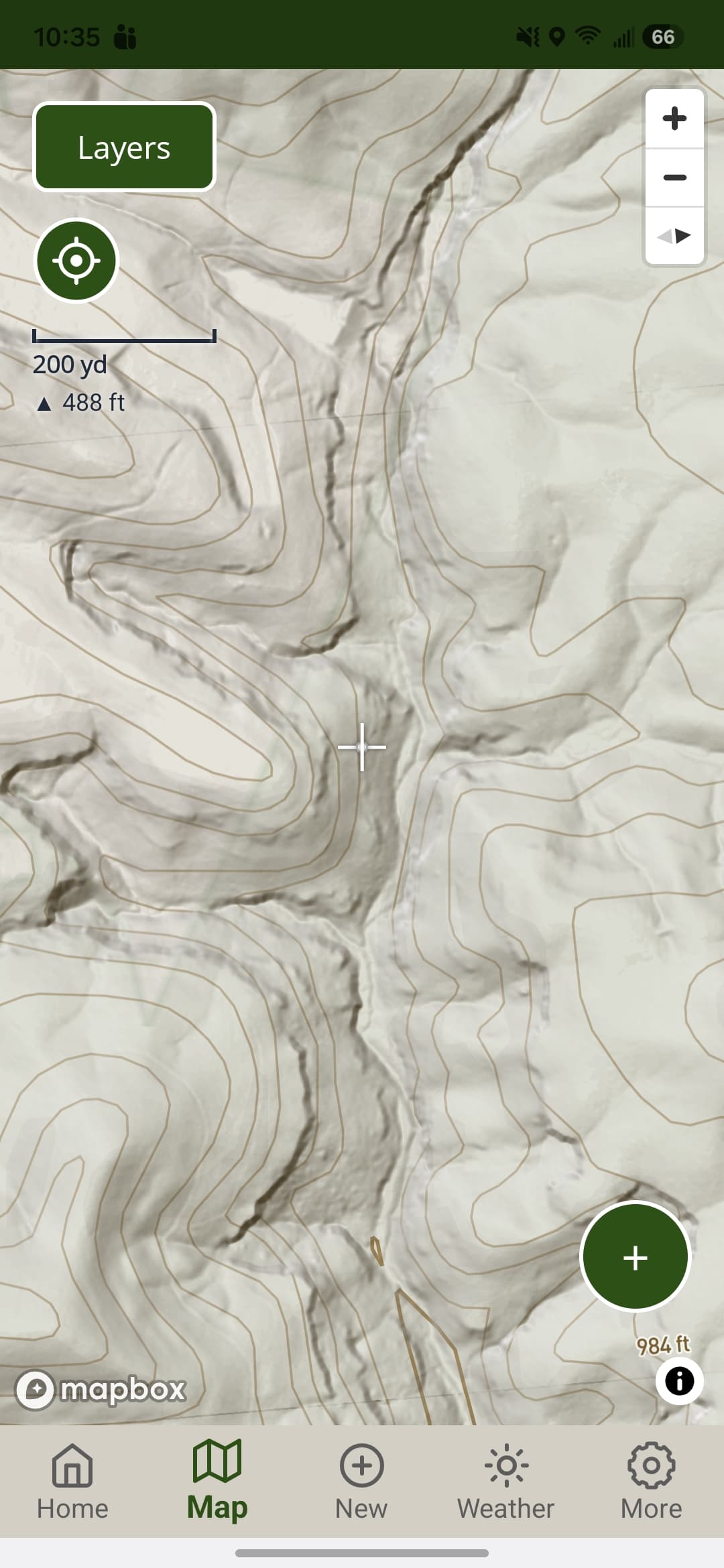
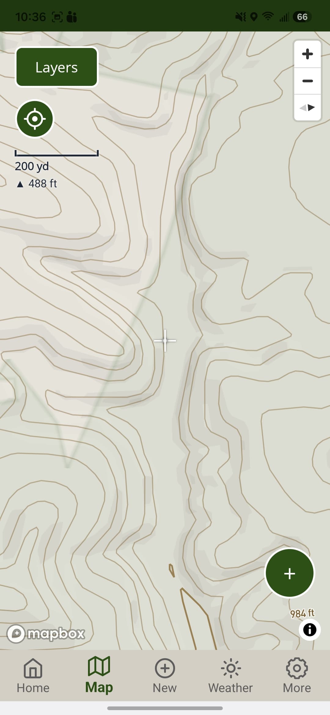
Map stands, sightings, sign, and important hunting locations alongside your journal entries. Mapbox-powered 2D and 3D Topo and Satellite styles, contour lines, live scale and elevation readout, and downloadable offline maps for no-signal country.
Map Drawing & Measurements
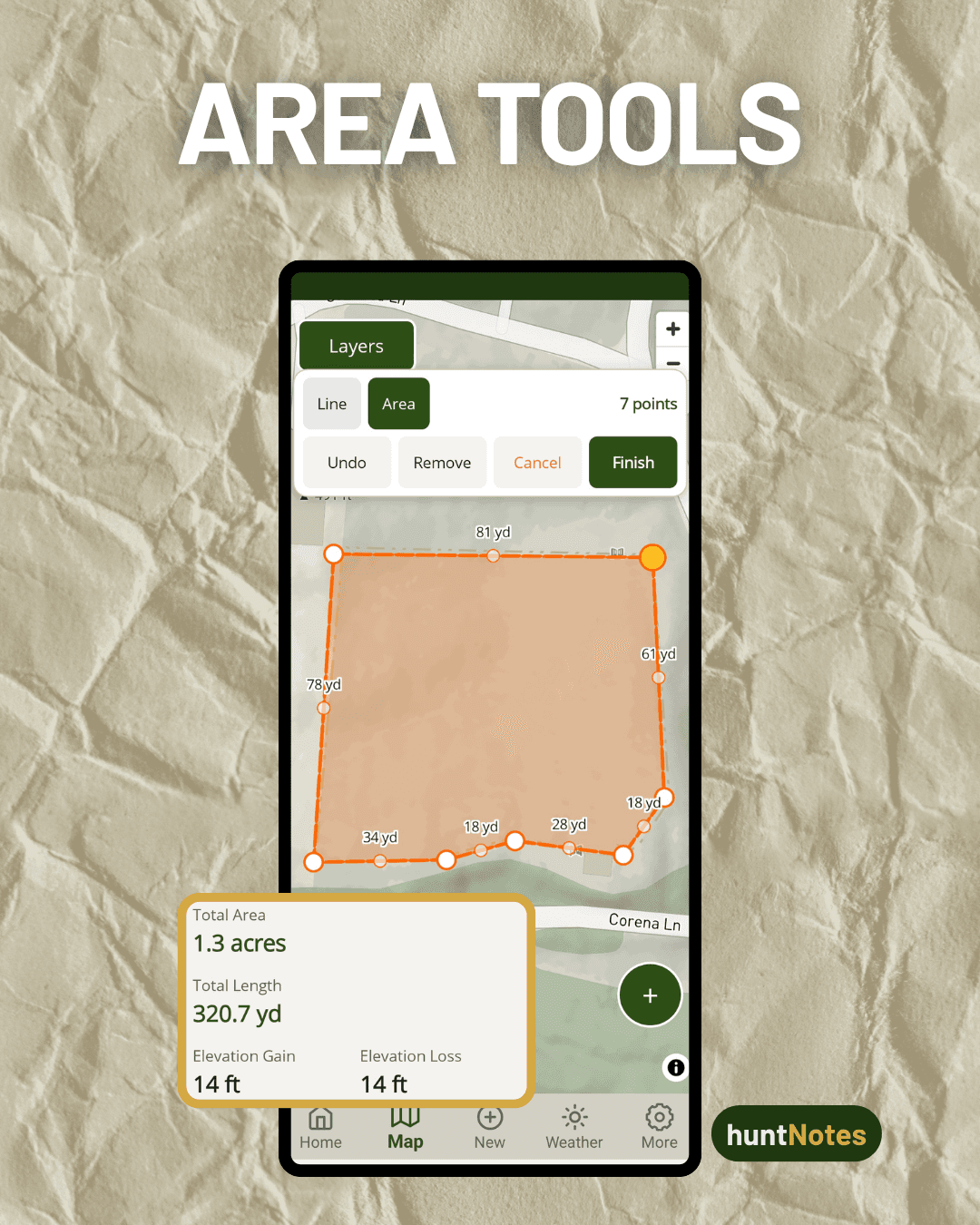
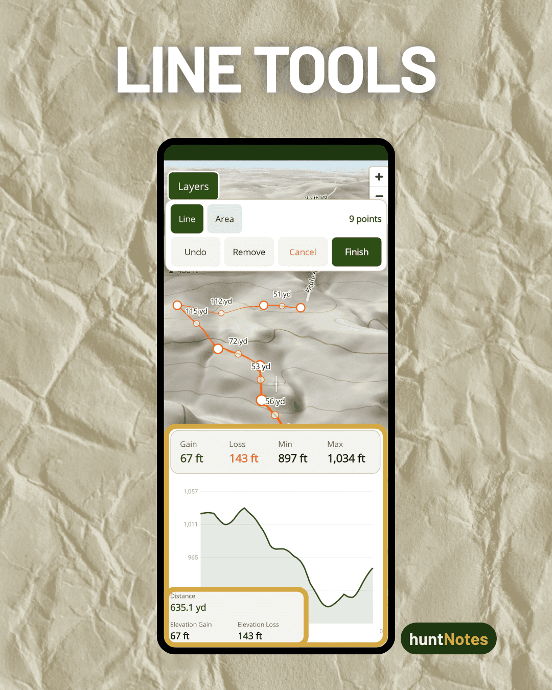
Draw and edit lines and areas right on the map with live distance and acreage as you go. Tap any drawn line to see its elevation profile, powered by Mapbox terrain data.
Property Parcel Boundaries
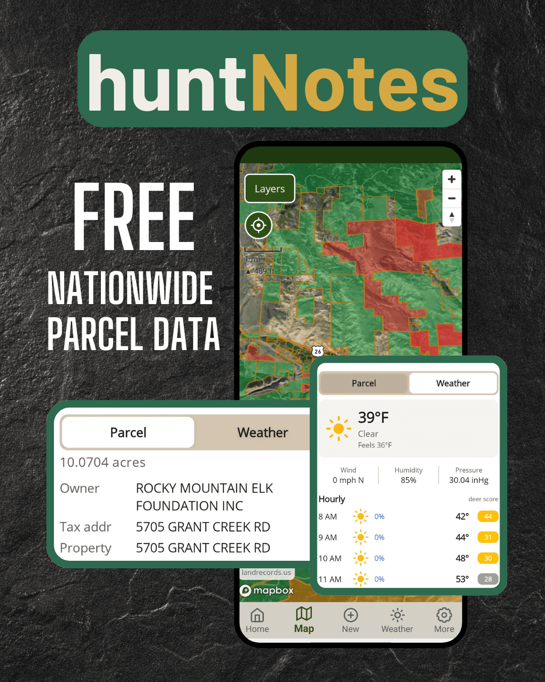
See property lines and public-access overlays with landowner labels, acreage, and a tap-for-weather parcel sheet. Classification is informational; always verify local hunting regulations.
Terrain Layers: LiDAR & Contours
Reveal subtle terrain, drainages, and benches with a high-resolution LiDAR/hillshade relief layer (USGS 3DEP, Premium), and toggle topographic contour lines on any topo basemap.
GPS Import & Export
Bring in tracks and boundaries from other apps, or share yours out, in every common GPS format: GPX, KML, KMZ, and GeoJSON.
Fish Mode
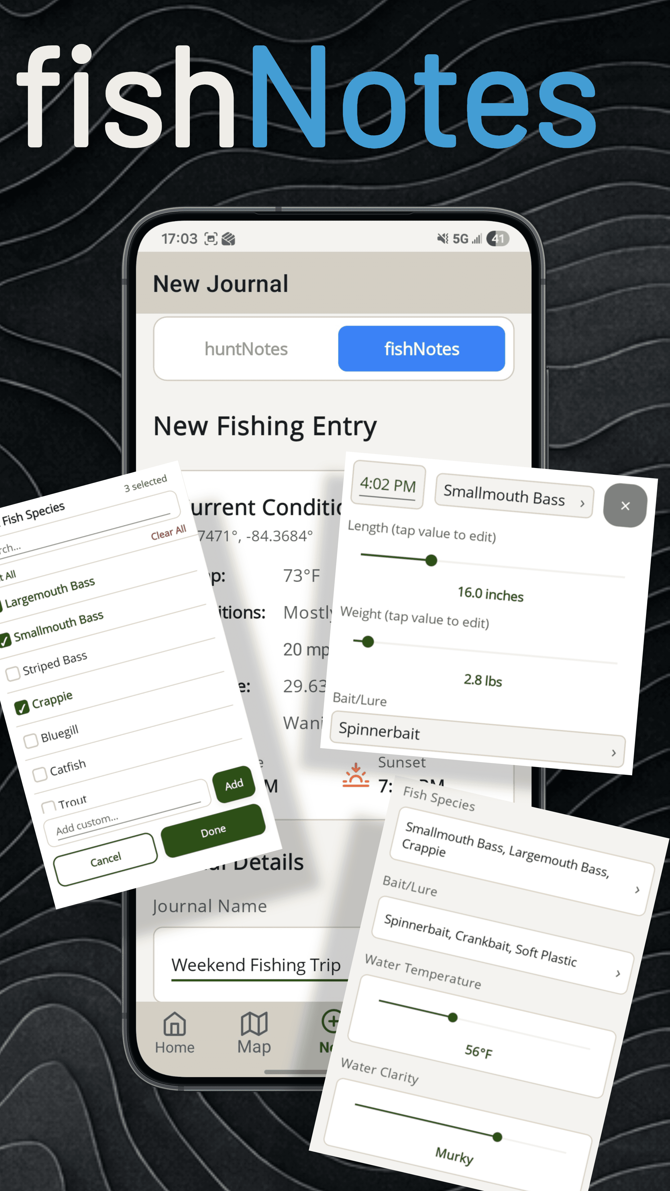
Switch to fishNotes mode to log fishing sessions, track catches by species with length, weight, and bait, and drop fishing-specific waypoints. Fishing analytics now include a species filter.
River & Stream Gauges
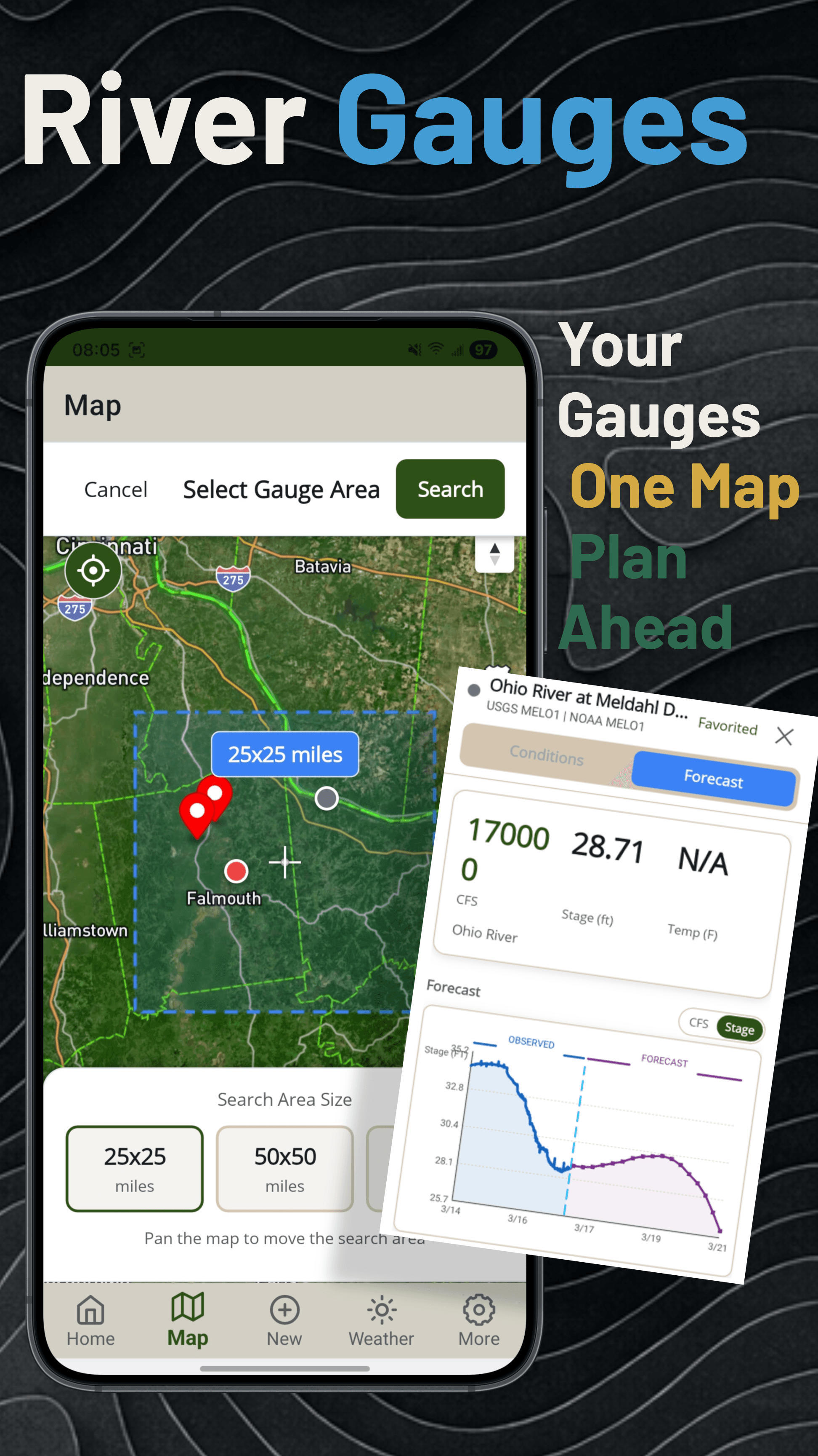
Monitor USGS and NOAA river gauges with real-time flow, stage, and water temperature. Set home rivers, define ideal flow ranges, and view color-coded conditions.
Active Sessions & QuickLog
Start a live hunt or fishing session and capture quick notes in seconds from a notification tap. Premium adds gentle in-session reminders to log sightings, with adjustable interval and count.
Ask My Data
Ask plain-language questions of your own journal and get answers built from your real data, all on your device. Premium feature.
Encrypted Backup & Auto-Backup
Automatic encrypted backups with one saved password and a reminder so you never lose a season's journal. Restore on any device, cross-platform. Your data stays yours.
More Than a Hunting Map App
huntNotes is built around the complete hunting experience. Record what happens in the field, organize your scouting history, and turn years of hunting data into insights.
Digital Hunting Journal
Log Every Hunt Before You Leave the Stand
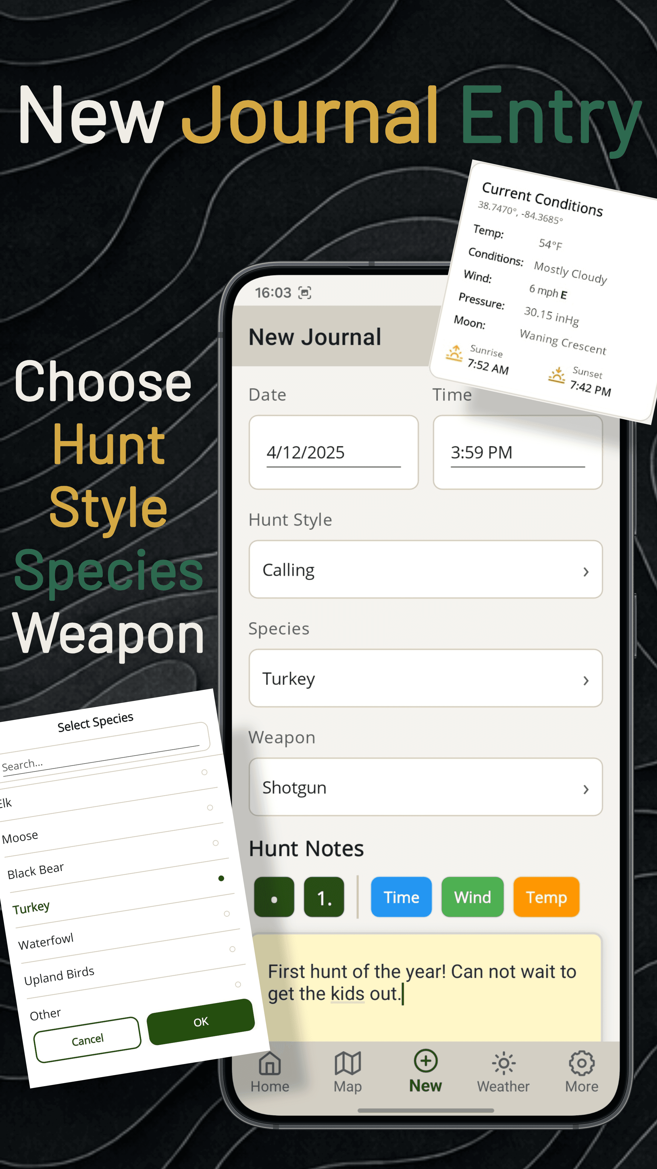
Capture hunt style, species, weapon, and freeform notes, all with the hunting conditions automatically recorded at the time of entry. No signal required.
Choose from 10+ hunt styles and 15+ species, with custom input support
Wind, weather, and moon conditions captured automatically
Add game sightings, harvest records, and field photos
Weather Tab
Three Tabs. The Whole Weather Picture.
Weather is now split into Overview, Insights, and Hunt Score, so you can plan from forecast to historical pattern to a data-backed daily rating without leaving the screen.
Overview — current conditions, weekly forecast, hourly outlook, and moon phase, all in one scroll
Insights — prevailing wind rose plus temp, precip, and wind trend charts across 2-week, 1, 3, and 6-month windows
Hunt Score — its own dedicated subpage, rating each hour from real NWS weather and time of year
Game Sightings & Harvest Records
Track Every Animal You See
Log individual game sightings with sex, count, and time. Keep male and female harvest records separately. Attach field photos directly to your journal entries. Everything stays on your device.
Timestamped game sightings with sex and count
Male/female harvest records per session
Attach photos from your camera roll or take in-app
Offline Maps
No Service. No Problem.
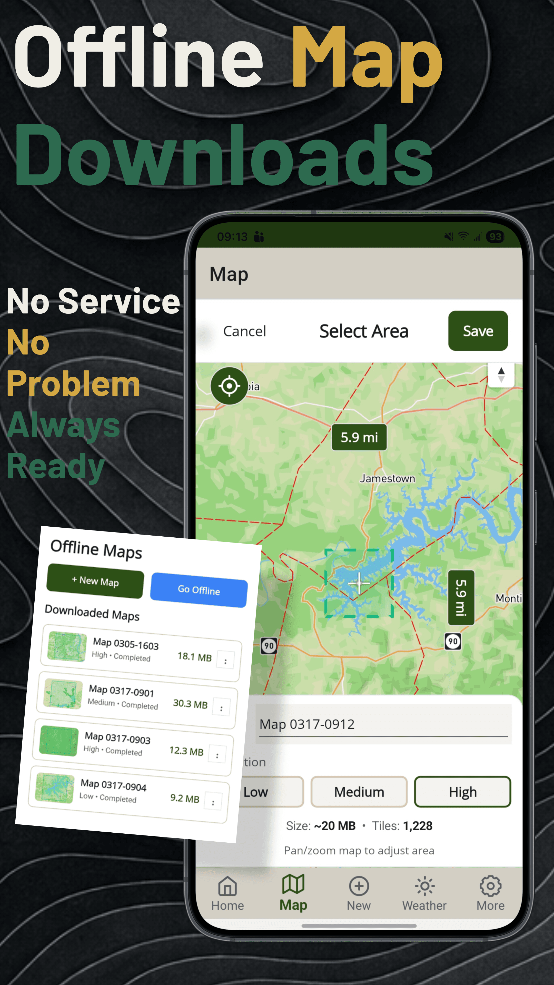
Select a region on the map, choose your quality level, and download it before you head out. Your saved maps in 2D Topo and 2D Satellite styles are ready even without a cell signal.
Select any area by panning and zooming the map
Low, Medium, and High quality download options
Manage multiple saved map regions from one screen
Drawing & Measurement
Draw, Measure, and Read the Land
Sketch lines and areas right on the map with live distance and acreage, then tap a line to see its elevation profile. Label and color every shape.
Area Tool
Drop points around any boundary and the polygon locks in total acreage and perimeter length as you go. Finish the shape for elevation gain and loss across the whole area. Label and color every polygon so they stay organized on the map.
Line Tool
Sketch any path on the map and watch live distance update with every point. Finish the line for a full elevation profile gain, loss, min, and max along the route powered by Mapbox terrain data.
New
Switching Apps? Bring Everything With You.
Full import and export of waypoints, tracks, lines, and areas in every standard GPS format. Move your existing map data into huntNotes from any other app and take it back out whenever you want. Nothing left behind.
What Moves
Waypoints
Tracks
Lines
Areas
Standard Formats
GPXKMLKMZGeoJSON
Bidirectional and free for every user. No Premium required.
See property lines and public-access overlays with landowner labels and acreage on the map. Tap any parcel for owner details or jump straight to its weather. Classification is informational; always verify local hunting regulations.
Landowner, acreage, and address on every parcel
Public-access overlays for where you can legally go
Tap to Weather for conditions, wind, and the hourly Hunt Score
Terrain Layers · LiDAR is Premium
See the Terrain Others Miss
Reveal subtle drainages, benches, and pinch points with a high-resolution LiDAR/hillshade relief layer (USGS 3DEP), and toggle topographic contour lines on any topo basemap.
LiDAR On
LiDAR Off
Drag the handle to compare. Arrow keys work too.
LiDAR / Hillshade (Premium)
A high-resolution USGS 3DEP relief layer surfaces subtle terrain features that standard maps flatten out.
Contour Lines
Toggle topographic contour lines on any topo basemap to read elevation and slope at a glance. Free for everyone.
Built for Anglers Too
Switch to fishNotes mode and get the same professional tools, purpose-built for fishing.
River & Stream Gauges
Search USGS & NOAA gauges by area, view real-time flow, stage, and forecasts on a satellite map.
fishNotes Mode
Log catches by species, length, weight, and bait. Track multiple species per session with water temp and clarity.
How It Works
Three steps from a hunt in the field to season insights you can act on.
Step 01
Record
Start a hunt, drop waypoints, log game sightings, snap photos, and jot notes. Every entry saves to local storage instantly, with hunting conditions attached. No signal needed.
Step 02
Observe
Track animal movement and deer activity through the season. Log scouting observations, keep harvest records by species, and drop waypoints for stands, scrapes, rubs, and bedding areas. All data stays on your device.
Step 03
Analyze
Analytics run locally on your device. Compare stand history, correlate hunting conditions with hunt results, review season insights, and find what actually puts game in front of you.
Simple, Honest Pricing
Free forever on the core plan. Try Premium free for 14 days — no credit card required.
Free
Core hunting and fishing journal features to get started.
Reviews from hunters using huntNotes as their hunting journal, straight from the App Store and Google Play.
5.0 out of 56 ratings across App Store
Great app
“This is one of the best hunting apps I've used. I especially appreciate the GPS tracking and offline map features, which are invaluable when hunting in areas with limited cell service. The weather forecasts, wind direction tools, and waypoint markers help me plan my hunts more effectively and stay organized in the field.”
Nat G.·App Store
“What I've been looking for. Something to keep track of my hunts and be able to log the weather, bar, etc. on days that I've seen action. Gonna be great for this year's deer season. Used it for keeping track of birds this year during turkey season. Great app!”
Tyler F.·Google Play
Nice app!
“Easy to use.”
TLSchlueter·App Store
Leave a Review
Your reviews help other hunters discover huntNotes. Tap your platform below to leave a rating and review.
What huntNotes does, how hunters use it, and what it costs.
What is huntNotes?
huntNotes is a digital hunting journal app for iOS and Android. It lets hunters record hunts, log game sightings and harvest records, map stands and sign, capture hunting conditions automatically, and analyze patterns across seasons. Your journal is stored locally on your device and works fully offline.
What does a hunting journal app do?
A hunting journal app replaces the paper logbook. It records each hunt with the date, location, stand, weapon, and species, captures the wind, weather, and moon phase at the time of the sit, and stores your game sightings and harvest records so you can review animal movement and hunt results season after season.
How do I track my hunting success?
Record every hunt, not just the successful ones. huntNotes logs sits with zero sightings alongside your harvests, then compares stand history, wind direction, temperature, moon phase, and time of day against your hunt results. Over a few seasons that shows you which locations and hunting conditions actually produce.
Can I use huntNotes as a deer hunting journal?
Yes. Deer hunting is the most common use. huntNotes supports 15+ species with custom entries, waypoint types for stands, scrapes, rubs, and bedding areas, timestamped sightings by sex and count, and an hourly Hunt Score that rates deer activity from real weather data and time of year.
Does huntNotes work without cell service?
Yes. huntNotes is local-first, so every journal entry, waypoint, sighting, and photo saves to your device with no signal required. You can download map regions ahead of time for offline use, and nothing you record depends on a connection or an account.
Is huntNotes free?
Yes. The core hunting journal, mapping, and scouting features are free forever. Premium is $4.99/month or $39.99/year and unlocks advanced analytics, 3D map styles, unlimited offline maps, LiDAR terrain, and extended forecasts, with a 14-day free trial and no credit card required.